martes, 25 de junio de 2019
Satellite data analysis has now become a mainstream of much geological reconnaissance and detailed mapping. There are currently some 30 Earth Observation imaging satellites acquiring data daily, with ground resolutions ranging from 30 m to 0.5 m, with concurrent archives growing exponentially.
In the author’s view satellite geology has tended to minimise, or overlook, the
continuing value of archives of pre-satellite conventional vertical stereoscopic mapping
air photography.
This monograph
is a portfolio of 97 data sets designed to demonstrate to students
and workers in the fields of land geoscience and land management the value in preliminary
site appraisals or mapping projects of the use of two data sources in a reciprocal
combined manner – conventional stereo airphotos and 30 m ground resolution
Landsat subscenes.
“For every site, geomorphology is the first thing encountered”. While geotechnical
knowledge is paramount, both quantitative and qualitative knowledge should be regarded
as important. The initial role of the physical geologist is qualitative, to establish
what geological phenomena exist in a site. “Once that is correctly decided, the subsequent
investigations can readily be developed, given the requisite time and finance,
to provide the degree of quantitative knowledge necessary”
(Hutchinson, p38).
Québec, March 2011 Lambert A. Rivard
Seguidores
GEOFIELD FANPAGE
Entradas Populares
-
MANUAL DE FOTOGEOLOGIA Publicaciones cientificas de la junta de energia nuclear *M. L. LOPEZ VERGARA Fotogeólogo al servicio de l...
-
Depósitos epitermales de alta y baja sulfuración: una tabla comparativa Antoni Camprubí*, Eduardo González-Partida, Gilles Levresse J...
-
Subdivisión de la Placa de Nazca en tres nuevas placas tectónicas y su incidencia con la sismicidad peruana actual* Subdivision of th...
-
MANUAL DE EVALUACION Y DISEÑO DE EXPLOTACIONES MINERAS MADRID 1997 *MANUEL BUSTILLO REVUELTA Doctor en Ciencias Geológicas F...
-
METAMORFISMO Apuntes de la asignatura Petrología Endógena II (Móduo I) *Javier Gómez Jiménez 2006 Metamorphism: a proc...
-
MANUAL DE PROCEDIMIENTON PARA EL REGISTRO GEOTECNICO DE SONDAJES PROYECTO EL CHOCO ESTADO DE BOLÍVAR, VENEZUELA Este docume...
-
FUNDAMENTALS OF GEOMORPHOLOGY Second Edition Richard John Huggett Routledge Fundamentals of Physical Geography This e...
Categories
- DESCARGAS (66)
- GEOLOGIA DE YACIMIENTOS MINERALES (23)
- GEOLOGIA DE CAMPO Y MINAS (19)
- GEOLOGIA ESTRUCTURAL (19)
- PROYECTOS MINEROS (11)
- GEOLOGIA GENERAL (9)
- GEOESTADISTICA - GEOFISICA - SISMOLOGIA - GEOQUIMICA (8)
- GEOMORFOLOGIA (8)
- METALOGENIA (7)
- MINERALOGIA Y CRISTALOGRAFIA (7)
- SEDIMENTOLOGIA Y ESTRATIGRAFIA (7)
- PETROLOGIA IGNEA Y METAMORFICA (5)
- GEOLOGIA DEL PERU (4)
- GEOTECNIA (3)
- GEOTECNIA MINERA (3)
- ESTABILIDAD DE TALUDES (2)
- FOTOGEOLOGIA (2)
- GEOTECTONICA (2)
- BIENVENIDO (1)
- GEOLOGIA DE LOS HIDROCARBUROS (1)
- HIDROGEOLOGIA (1)
- MECANICA DE ROCAS (1)
- PÁGINAS DE GEOCIENCIAS Y MINERÍA (1)
- TOPOGRAFIA MINERA (1)
- VULCANOLOGIA (1)
Blog Archivo
Buscar este blog
Blogroll
ACERCA DE
Con la tecnología de Blogger.
GEOFIELD

GEOFIELD PERU
BUSCAR
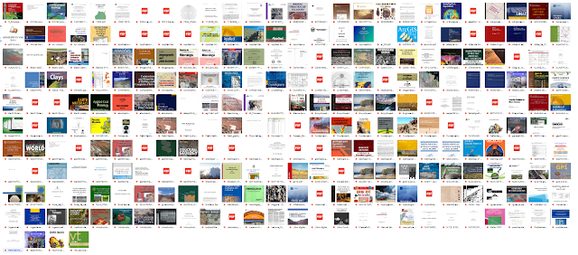
LIBROS DE GEOCIENCIAS + DE 500(PRIMERA PARTE)
LIBROS DE GEOCIENCIAS + DE 500(PRIMERA PARTE) GEOFIELD Comparte la primera parte de LIBROS DE GEOCIENCIAS. Son mas de 500 libros ...

Entradas populares
Copyright ©
GEOFIELD | Powered by Blogger
Design by Flythemes | Blogger Theme by NewBloggerThemes.com


0 comentarios:
Publicar un comentario